Day 102 – Thursday, September 23, 2010
088°13.553’ W
37°00.438’ N
Grand Rivers, Kentucky
Green Turtle Bay Marina (day 1)
 |
Approaching I 57 bridge |
 |
| Confluence of Mississippi & Ohio |
Today we learned a great deal about rivers and how they work! I thought the Ohio water level would be at summer stage and not affected by the rains we encountered in Illinois that messed up the Mississippi. Turns out that the Mississippi is flowing so fast that the water has risen an additional 5 to 7 feet where the Ohio flows into the Mississippi blocking the Ohio from flowing into it. With the Ohio water level up, the barge traffic is backing up on the river due to high water problems at the locks.
 |
| Barkley Lock & Dam |
 |
| Cumberland River |
What this meant to the Bades and us was the going was slower than planned and day light was running out! We were about to enter the Cumberland River that is narrow and snakes itself all thru the country side and requires day light to safely find your way. To increase my speed was to burn more fuel and fuel was a concern for this portion of the trip. While at anchor the evening before I had added the extra 40 gallons of fuel that I had taken along for an emergency. Running out of daylight was not a contingency I had planned for. For two and a half hours we increased our speed burned a lot of fuel and got to the marina as the sun was very low in the sky.
 |
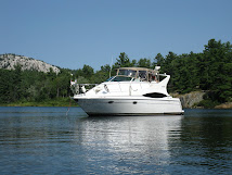
| Arriving at Green Turtle Bay |
We celebrated our safe trip with a few cold beverages then had dinner at the Yacht club at the marina.