Saturday, August 21, 2010

Day 86 – Tuesday, August 17, 2010

088°37.755’ W
44°17.979’ N
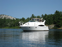
Seneca, Illinois (Spring Brook Marina)

Leaving Hammond
View of City
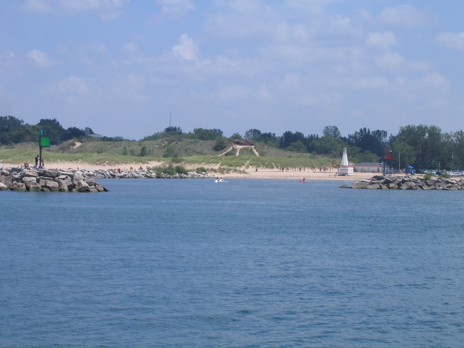
Entering the Calumet River
Leaving Lockport lock
Everyone was up early and both boats were underway by 7 am. The lake was calm as we entered the river. Nine hours later we arrived at Spring Brook marina in Seneca, Illinois. Our trip down the river was pleasant and uneventful which in the past wasn’t that way. We plan to stay here for a few weeks and have the boat detailed and checked out prior to starting the next phase of this adventure. During the next few weeks we will complete a long list of maintenance items.

After getting the boat secured, we had dinner at the marina restaurant then crashed for the night. The next morning August 18th, Becky delivered Bruce’s car to the marina and we grabbed our tooth brushes and headed for home. We arrived home before noon and started the task of trading in our sea legs in for those of a land lubber. Tomorrow we will return to the boat and remove the food from the refrigerator and pack up our personal items to take home.

The next few months will take us south to the Gulf of Mexico and if the oil problem is resolved we will cruise to the Florida Keys then up the east coast and re-enter the Hudson River close to New York City.

As of this posting of the blog we will be idle and will resume shortly after Labor Day when we get under way again. For now we will take this time to visit with family and get some much needed work completed on the boat.
Day 85 – Monday, August 16, 2010

41° 41.796’ N
087° 30.338’ W
Hammond, Indiana

Leaving New Buffalo
The day started out with high winds and small craft warnings. I walked down the dock to meet with Dave and Bruce at 6:15am to discuss weather ------ then returned to our boat and went back to bed! That’s not the way to start your day.

Leaving Michigan City
We all went to lunch together and then walked to the lake to check on lake conditions. It wasn’t the best weather conditions for a boat ride but we left New Buffalo by 2:45 pm and proceeded to Michigan City for fuel. The ride was unpleasant but we thought that getting that far would get us into the river the next day. After reviewing improving weather conditions, we decided to proceed to Hammond to get an early start, which we did - arriving after 7 pm.

First view of Chicago skyline
We were tied up across from the boat Bulldog Sally that we have seen from time to time. With luck we hope to meet up with Cindy and Paul as they move down the river. While having a dock side visit, their cat jumped into the lake and used up one of its nine lives before Paul jumped in and rescued him. We will chalk that incident up to some unexpected excitement!

Sunday, August 15, 2010

Day 84 – Sunday, August 15, 2010

41° 47.806’ N
086° 44.947’ W
New Buffalo, Michigan (day 3)

Today was a laid back do nothing type of day. The six of us walked to a buffet breakfast, at the Yacht Club, which was excellent. Bruce did a few chores on his boat with the help of Dave and the ladies went grocery shopping. This was followed by some of the group falling asleep in the shade and others having a few beers in anticipation of dinner. Chris made Italian beef sandwiches that were great. And yes ----- we walked into town for ice cream.

Weather permitting we will depart this harbor at 7 am and go to Michigan City, Indiana for fuel. They have the best prices on the lake and when you need 200 gallons it’s worth the extra time!

From there we will cruise to the Chicago River entrance next to Navy Pier and proceed down the river toward Ottawa. Depending on weather, daylight and barge traffic it should take a few days.
Day 83 – Saturday, August 14, 2010

41° 47.806’ N
086° 44.947’ W
New Buffalo, Michigan (day 2)

It was good to see Chris, Bruce, Becky and Dave again. They arrived sometime in the afternoon. After a few trips to the car to unload it and get their clothing and supplies to the boat we all had a few drinks then went to a birthday dinner at the New Buffalo Yacht Club. I didn’t know the person but was made welcome and the food was good!

We returned to the Bade’s boat and watched a great display of fire works then called it a night.

Friday, August 13, 2010

Day 82 – Friday, August 13, 2010

41° 47.806’ N
086° 44.947’ W
New Buffalo, Michigan

Arriving in New Buffalo, MI
Heading to Hammond, IN
This morning we said our good bys to our friends from the club Glena, Bob, Mary and Frank and the three boats left the harbor in South Haven in a long procession. As we entered the lake two of the boats turned to the southwest – heading to Hammond, IN – Barb and I headed straight south to New Buffalo. We actually had good weather and smooth water. We entered the harbor and located our slip that Bruce had arranged with no difficulty.

The city is having some type of festival and have the streets closed with different bands playing on a stage. There are lots of street venders selling all of the things you shouldn’t eat but one treat doesn’t hurt.

The weather has been so hot that Barb and I are both a little bit fatigued from being out in it. We returned to the boat for a quiet evening before Chris and Bruce Bade, Becky and Dave Carlson arrive tomorrow. The plan is to stay here three nights and depart Monday morning for the River.
Day 81 – Thursday, August 12, 2010

42° 24.209’ N
086° 16.656’ W
South Haven, Michigan (day 2)

Today was a fun day. We had a chance to get a few necessary chores done after sleeping in late!

The town started to hum as tents were erected and a stage was set up 100 yards from our boat for the annual blueberry festival.

Glenna, Bob, Mary, Frank, Barb and I all met in town and had a few drinks then went to dinner across the street to an Italian restaurant, which turned out to be enjoyable.

On returning to the boat there was a dock party about ten boats down from our boat with a professional band playing until 10 pm. Barb and I sat in the front of our boat and enjoyed a great concert with front row seats.

Tomorrow, weather permitting we will move to New Buffalo, Michigan and await the arrival of Chris and Bruce on Saturday. Barb and I are really looking forward to seeing them again and having them join us while cruising the loop.
Sunrise leaving Grand Haven
Day 80 – Wednesday, August 11, 2010

42° 24.209’ N
086° 16.656’ W
South Haven, Michigan

Grand Haven Lighthouse
We had a first today! While underway we received an emergency warning from the Coast Guard to get off the lake ASAP due to an impending storm with gale force winds. We were ten miles from Holland and cranked up our speed and headed for their entrance off of the lake. We no sooner got to the break wall when the storm hit. I must say it was a lulu but we were able to find a safe place to anchor and did so.

Storm near Holland, MI
After about an hour and a half on the hook we got underway again and arrived in South Haven at noon. While moving up the channel approaching the marina I radioed the harbor mentioned that our friends might be there and if so could we get into the same harbor. When the harbor person asked their names our friend Bob from the club answered the call and told her where they were. It was really great to meet up with some old friends. We had a few beers and pizza and caught up with the club news.

We were able to get two nights here which was a pleasant surprise. They have reserved all the slips for the weekend due to the annual blueberry festival.

Tuesday, August 10, 2010

Day 79 – Tuesday, August 10, 2010

43° 04.022’ N
086° 14.034’ W
Grand Haven, Michigan

First of all – HAPPY BIRTHDAY – to son-in-law Mark!

Leaving Ludington
S.S. Badger leaving Ludington
It was a great day to put some miles under us. Half of the trip was in fog and haze but the seas were flat with no wind! As the day progressed we kept extending the range of our trip until we said Grand Haven was enough. We called ahead and reserved a slip so that eliminated any guess work if we had a place to stay. This is high season for boaters, and finding space to stay is becoming harder and harder.

NOAA weather buoy
Arriving at Grand Haven Channel
Tomorrow is a little iffy for dock space in South Haven and the weather conditions may preclude us getting there. If we make it we will try to meet up with some prior dock mates from the Starved Rock Yacht Club! Barb and I have been chasing them for most of the week and are close to closing in on them.

Time for sleep as tomorrow will be an early day – underway at first light!
Day 78 – Monday, August 9, 2010

45° 57.256’ N
086° 27.291’ W
Ludington, Michigan

First of all – HAPPY 24th ANNIVERSARY – to Keith & Merri!

Leaving Frankfort
We had another rough day on the lake. Once in the harbor we fueled up and were assigned to space on the wall which was quite pleasant. Barb and I then rode our bikes to see the Badger the last coal fired ferry boat on the Great Lakes. At that point in time we threw in the towel and got some sleep!
Loading the S.S. Badger

S. S. Badger leaving Ludington
Tomorrow we will try to make some time up and push as far as the weather and our endurance will let us go.
Day 77 – Sunday, August 8, 2010

44° 37.914’ N
086° 14.070’ W
Frankfort, Michigan (day 2)

Yes, we are taking another weather day. The local tour boat reached the break wall this morning and turned around and returned to her dock! The word at the harbor masters office is that when you can see water coming over the break wall the waves are a minimum of 4 feet but more probably 5 to 6 feet sometimes more! No one left the harbor today it’s just too rough and dangerous out there. As protected as this harbor is we are rocking back and forth just from the surge coming through the harbor entrance a mile away! Our neighbor, another AGLCA member is next to us in a 48 ft. Krogen. Even they are rocking in there slip, and there isn’t any way for any of us to stop the action.

It turns out that there are 7 looper boats flying the AGLCA pendent in port and we will all get together later for a pot luck dinner. In the past three years Barb and I have meet some great new friends at impromptu events such as this. There are some big boats here

If the weather improves we will get under way when the seas flatten and head south.

Saturday, August 7, 2010

Day 76 – Saturday, August 7, 2010

44° 37.914’ N
086° 14.070’ W
Frankfort, Michigan

Last evening at anchor was spectacular with mild cool breezes and a sky full of stars that was breath taking! We did all of our usual chores after dinner in preparation of our next day cruise. We turned in around 10 pm and were enjoying a good night’s rest, when the wind switched 180 degrees and blew straight into the harbor! The anchor alarm went off which meant we were dragging our anchor due to the high winds. The rest of the night was spent on watch waiting for the moment that it would be safe to weigh the anchor and get out of the harbor and ride out the storm. Our time came just before day break and we were successful lifting the anchor and getting out of the dark harbor. A few of the boats in the harbor didn’t have anchor lights on that could be seen which made getting underway somewhat stressful!

We were prepared to cruise another 75 miles but cut our cruise short when an unpredicted wind stirred up the lake with waves and rollers building to 4 feet with occasional larger waves! When we had enough (which didn’t take long) we were 3 to 4 miles from safe harbor in Frankfort, Michigan - so here we are! Tomorrow isn’t looking to good for moving on - but we will still get up early checking the weather with much enthusiasm and anticipation to get underway.

Off of the lake the weather is pleasant so we took our free time and rode our bikes around the town.
Day 75 – Friday, August 6, 2010

45° 01.797’ N
086° 05.654’ W
At anchor - South Manitou Island, Lake Michigan

Mackinaw Bridge
Looking towards Mackinaw Island
The day started out slow. The weather didn’t look very promising outside but the forecast was positive. There was quite a few boaters milling around the harbor masters lounge checking weather and when every one there convinced each other how great it was going to be off they went! Within a half hour we topped off our fuel tanks and were underway. The first four hours were a little rough then it started to improve slowly, by the end of our ten hour run it was down right pleasant! Barb and I kept extending our destination as the weather improved. Tonight were anchored in a beautiful bay of South Manitou Island. We anchored in 40 feet of crystal clear water. We just finished a great dinner cooked on the grill while watching the sun set. It looks like the night will get cool but with out wind! That’s a great combination when on the hook.
Grays Reef Lighthouse
Eveing at South anitou Island

Tomorrow we will get under way at first light. We will try to get as many miles under us as possible before the seas start to build. Today we cruised 100 miles a very long day. What will tomorrow bring?
Windmills at Mackinaw Marina
Day 74 – Thursday, August 5, 2010

45° 46.714’ N
084° 43.308’ W
Mackinaw City, Michigan (day 3)

First the Good news – John’s boat has been repaired and their free to move on! The bad news is we’re stuck here because of bad weather. Today we experienced a major storm in the harbor. While in the harbor office I was told a major storm was a mile away and moving this way. By the time I walked to the boat the rain had started. Within minutes all hell broke loose. I guess it’s just another day of living on a boat in the northern Great Lakes. Most of the boats that came into the harbor today are here because of the stormy weather. This is a beautiful and safe harbor to hide in.

After the storm blew over we walked into town and had a pleasant dinner then walked around for an hour.

Tomorrow’s looking like we may have a chance to enter Lake Michigan! Stay tuned we I think we have a 50 / 50 chance of getting out of here.

Wednesday, August 4, 2010

Day 73 – Wednesday, August 4, 2010

45° 46.714’ N
084° 43.308’ W
Mackinaw City, Michigan (day 2)

First of all - HAPPY BIRTHDAY - Jori, Barb's daughter-in-law.

Not much is happening here. John’s boat was worked on while in his dock today. It’s been determined that the boat needs to be lifted from the water first thing tomorrow and have the prop shafts tested and his back up props installed in place of the props now on the boat.

Barb and I will stay around and offer our boat for shelter while there boat is on the hard! It’s now looking like we will get out of here Friday at the earliest. The weather doesn’t look very promising for tomorrow ------- boat repair or not!
Day 72 – Tuesday, August 3, 2010

45° 46.714’ N
084° 43.308’ W
Mackinaw City, Michigan

First of all – HAPPY “25th” ANNIVERSARY – to Sherri & Mark!

Leaving DeTour
De Tour Lighthouse
Today was a slow and tedious day. We didn’t see much for five and a half hours due to haze and fog! Within a few miles of the harbor just past the light house that sits in Lake Huron, we could see shadows about a mile off even though the sky and shore line had disappeared from our sight. The feeling I had reminded me that as a young boy we would make tents out of bed sheets. While in the tent every thing was bathed in white light but you couldn’t see any thing on the out side of the enclosure, that’s the way it was most of today! As we came closer to the mainland the sky came into view but not very much of the shore line. Once in the harbor it was like a different world. There wasn’t any fog, rain or any unpleasant weather to be dealt with. With blue skies over head, we rode our bikes into town and had pizza and a few beers before calling it a day.
Mackinaw Island

Tomorrow John’s boat will be lifted out of the water and have the port prop and shaft checked. There seems to be some type of problem and its time to get it repaired before something major breaks!

We will stay with John and Barb until their boat problem is diagnosed tomorrow and if repaired tomorrow follow them into Lake Michigan via the Straits of Mackinaw! Once in Lake Michigan we will part company for three or four weeks. They will tour part of Green Bay and the Wisconsin shore line before crossing over to the Michigan side and entering the Illinois River. Barb and I will head south down the coast of Michigan and steer for the Illinois River. We will leave the boat and return home for a few weeks, while having some work done on the boat. We plan to rejoin the Flints somewhere on the Illinois River before heading south to the Gulf of Mexico. We haven’t decided if we will enter the Gulf at this time due to the oil problems!
Day 71 – Monday, August 2, 2010

45° 59.801’ N
083° 53.972’ W
De Tour Passage, Michigan

Leaving Sault Ste. Marie
Ore carrier we followed
Today our master plan didn’t work to well! We postponed our departure until noon which was going to allow extra time for the bad weather to pass over head! It looked like the plan was working as the skies started to clear, so we got under way close to noon. As we left the harbor we followed a large ore carrier down the river and decided to follow it to De Tour Passage. We hadn’t been underway very long when a rain squall hit------ completely blocking our vision and making our radar useless. It rained so hard that our visibility was limited as if we were in heavy pea soup fog. We slowed to a crawl and worked our way down the river until some visibility returned.

At best the skies were very over cast with light to heavy rain, haze or light fog every mile we traveled. The scary part was that we were in a major shipping channel with large ships that couldn’t be seen as well as fisherman in small boats moving in different directions just trying to get out of the storm. In many areas the water is very shallow just outside of the buoys that mark the channel! As we moved down the crooked river I knew the ore carrier was ahead of me from his wake even though I couldn’t see him visually or on my radar. This was the most crooked stretch of water we have encountered this summer. We were much relived when we arrived safely at our destination.

Typically as this 41 mile “ADVENTURE” came to a close the weather cleared and it’s actually pleasant tonight.

Tomorrow light rain is predicted but we will wait and see if we move on to St Ignace!

Monday, August 2, 2010

Day 70 – Sunday, August 1, 2010

46° 29.975’ N
084° 20.255’ W
Sault St. Marie, Michigan (day 2)

So much for our day of R & R! Today was a good day to clean the boat, do laundry and make ready for our departure from Lake Superior. In between washing the boat we had some rain, sun shine and a mixed bag of weather! We did take time to have Barb and John over for a few drinks and snacks during our rain break.

Later in the evening, Barb and I rode our bikes into town for ice cream, a great way to close out the day.

Tomorrow, weather permitting, we’ll head for De Tour Passage and stay the night in De Tour Harbor Marina. We will travel the St. Marys River which connects Lake Superior with Lake Huron. From there we move westward towards the Mackinaw Straits.
Day 69 – Saturday, July 31, 2010

46° 29.975’ N
084° 20.255’ W
Sault St. Marie, Michigan

First of all – HAPPY BIRTHDAY – to son-in-law Ray.

Whitefish Point Harbor
Whitefish Point Lighthouse
Edmund Fitzgerald Bell
We got our folding bikes out of storage and rode to the lighthouse and museum which turned out to be very special. All of the displays were extremely well done. One of the main attractions is the ships bell from the Edmund Fitzgerald. It’s now the final resting place for the bell by request of the crew’s, family members. The Edmund Fitzgerald was the largest ship ever to sink on the Great Lakes. The museum is a tribute to all that have lost their lives on the great lakes.
Arriving at Soo locks

Spectators at locks
In Soo locks
On return to the boat we departed Whitefish Point and steered for the Soo Locks. We followed one of the super carriers 1013 long for four hours then entered parallel locks in the same time frame. There is a large visitor center at the locks and there was hundreds of spectators watching us enter then lock through. It actually was a lot of fun talking to the people in the viewing area. We were out of the lock and in our harbor, fueled up and securing the boat in her slip when the ore carrier passed our harbor entrance.

As soon as we secured our boat we were on our bikes and off to get one of the best hamburgers we have ever eaten. We found this small drive-in on our way into Lake Superior and said at the time we would return on our way out.

Tomorrow might be a day of R & R!
Day 68 – Friday, July 30, 2010

46° 45.661’ N
084° 57.831’ W
Whitefish Point, Michigan

First of all – HAPPY BIRTHDAY – to granddaughter Katharine.

Sunrise iin Munising
Arriving at Whitefish Point
Today was a long day. We did over 90 miles and made Whitefish Point that has a harbor of refuge which means it’s a protected harbor that is free and has little else to offer.

Tomorrow we will visit the maritime museum about a mile away. Right now its time for some sleep!